Thanks to John Stockham for this excellent write-up!
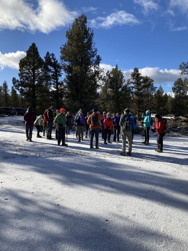
On Sunday November 19 approximately 30 hikers joined the "show-and-go" hike to Fryrear Canyon. About 20 of the hikers met at Thump Coffee at 9. The remainder met the group at the trailhead. While the number of attendees was quite large, we split into 3 groups (led by Kelly Cleman, Eric Ness and John Stockham) and managed to not overwhelm the trail. Normally, this area is not heavily used - so we apologize for disrupting the solitude of the few hikers we encountered.
Fryrear Canyon is located about 20 miles northwest of Bend between Tumalo and Sisters. The route is accessed from the recently constructed Fryrear Trailhead, which has been developed by BLM for hiker and equestrian access. to this part of the Cline Buttes Recreation Area. The trailhead parking area is located off of the east side of Fryrear Road approximately 2 miles north of Highway 20. There are no formal signed trails to the canyon - but the area is criss-crossed by numerous informal horse trails and old jeep roads.
Most of the CONC group hiked a 3 1/2 mile looped route through the canyon. A couple of adventurous hikers expanded the hike to include a second canyon to the east of Fryrear Canyon. It is easy to get disoriented in the maze of horse trails and old roads, but fortunately John and Eric scouted the area a couple of days earlier to flag the route through to the canyon. The flags were removed after the hike.
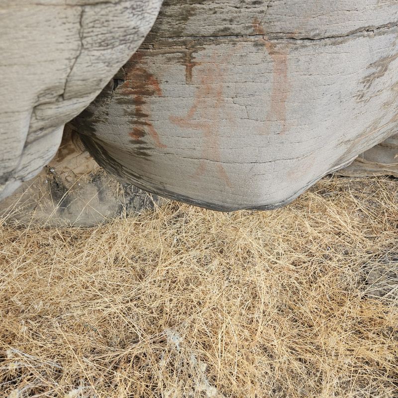
Fryrear Canyon is an excellent example of a dry desert canyon consisting primarily of Deschutes Formation rocks that originated from the "ancestral High Cascades" 4 to 7 million years ago. In this particular canyon, most of the rock walls are formed of andesitic basalts that feature interesting "platy" outcrops seen from the trail. Further downstream, in Wychus Canyon and along the Deschutes River, the Deschutes Formation includes a mix of various igneous rock and sedimentary rock of volcanic origin. There is evidence along the route that water flowed through the canyon, most likely dating from the numerous intermittent glacial periods that impacted the Cascades . Other highlights on the hike included a well-preserved pictograph, ample evidence of pack rat settlement, markings from various birds of prey, and an interesting pocket of ponderosa pines and Great Basin wild rye indicating the presence of water not too far below the surface. We encountered numerous large ant hills that were fortified by industrious ants that have hauled "boulders" of ash and pumice to protect their colonies. Much of the surface outside of the canyon consists of a mixture of Mazama ash that erupted from what is now Crater Lake approximately 7,500 years ago, volcanic ash from more local eruptions, and wind-blown deposits. The hike involved only 200 to 300 of elevation gain.
The Fryrear Canyon area is a wonderful fall and winter hiking destination close to town, but it should be noted that portions of canyon proper are closed from February 1 to August 31 for protection of nesting birds of prey. The protected area is well-posted.